
Wooden Maps in Kids’ Rooms: Fun Ways to Teach Geography
the Map store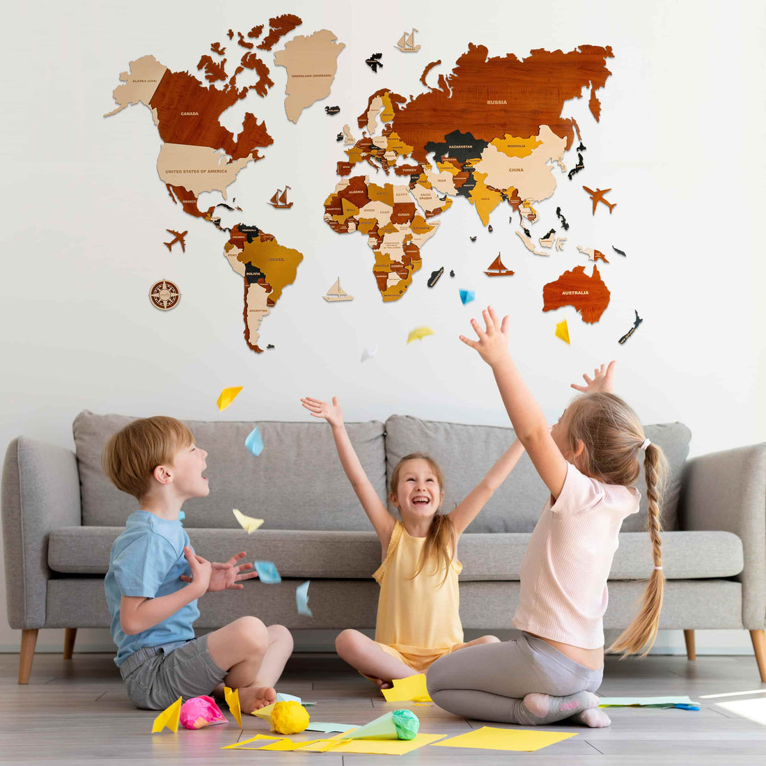
In today’s connected world, helping kids understand geography is more important than ever. One creative and engaging way to bring the world into their room is with wooden world maps. These stylish, hands-on tools double as both décor and learning aids, sparking curiosity while adding charm to any space.
Why Wooden Maps Work
Wooden maps are more than just pretty—they're tactile, sturdy, and interactive. Kids love touching and exploring them, which makes learning feel more like play than study.
Benefits:
-
Visually engaging
-
Durable and long-lasting
-
Encourages hands-on learning
Real Feedback in Action
Want to see how kids actually react to our maps?
Watch this short video of a young explorer engaging with their wooden map — their excitement says it all!
👉 Watch the video on Instagram
Types of Wooden Maps
World Maps

A wooden world map is a fantastic visual tool to introduce your child to the globe. It allows them to see how continents and oceans fit together, building a foundation for global understanding. These maps often feature 3D elements, making the experience even more tactile and engaging for curious young learners.
Benefits:
-
Easy way to start cultural conversations
-
Visually illustrates continents, oceans, and borders
-
3D design boosts spatial understanding
Country Maps

A wooden country map zooms in from the global view to focus on a single nation, allowing children to explore its geography in more detail. Whether it’s their home country or a place of interest, these maps make learning about regions, landmarks, and history much more relatable.
Benefits:
-
Builds deeper national identity and understanding
-
Encourages learning of regions, capitals, and heritage
-
Great for school projects and national holidays
State Maps

A wooden state map helps kids explore the geography of individual states or provinces. It’s especially helpful for understanding the layout of a country and gaining a stronger connection to their local and neighboring regions.
Benefits:
-
Makes local geography tangible
-
Helps children learn capitals, state symbols, and major cities
-
Encourages memory through personal connections (e.g., family, vacations)
City Maps

A wooden city map gives kids a fun and practical way to understand the layout of their town or nearby cities. It connects everyday experiences—like going to school or the park—with a broader understanding of their community.
Benefits:
-
Teaches spatial awareness and navigation
-
Complements history and civics education
-
Builds civic awareness and a sense of belonging
Push Pins

A country push pin map adds a personal and interactive element to your child’s wooden map. With each pin, kids can mark places they’ve been, dream destinations, or places they’ve learned about—turning geography into a living, growing story.
Benefits:
-
Makes travel memories visual and lasting
-
Encourages goal-setting and dreaming about the world
-
Adds an interactive, evolving component to the map
Conclusion
Wooden maps offer a unique blend of education, creativity, and style—turning any child’s room into a space for curiosity and discovery. Their tactile, visual nature helps make learning geography more engaging and memorable. Whether used for daily exploration, storytelling, or tracking adventures, these maps inspire kids to connect with the world in meaningful ways.
Start small, let them explore, and watch their understanding of the world grow—one map at a time.
Explore handcrafted options at The Map Stores and bring learning to life through beautifully designed wooden maps.